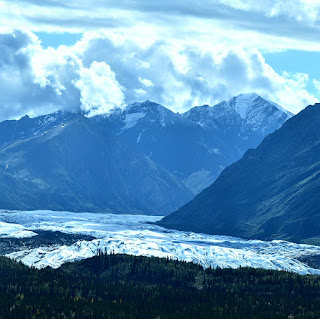
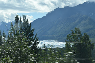
We stayed in Anchorage for another 2 weeks while the Cummins dealership and then Pierre worked on Esprit, this took me off our schedule and it was becoming colder and dark at night. I wanted to head back to Fairbanks and see some more of the area up there, but our time in Alaska was coming to an end and we needed to start heading south before the snow and the winter set in and with Esprit sick...well.. I was loathing to leave Alaska, so we kinda started to head back to the lower 48. We left Anchorage and drove The Glenn Highway this highway runs northeast to agricultural Palmer, then twists east along the Matanuska River Valley, sandwiched between coastal and interior mountains. We stopped at Matanuska Glaicer this is the largest one in the State that is accessible by car.
I really wanted to do the The Egerton Highway, this is a scenic paved road leading east, from its junction with the Richardson Highway, to the small town of Chitina, then you get on the McCarthy Road, this crosses the Copper River to the Kennicott River, leaving you about 1 mile west of the town of McCarthy and 6 miles from the historic mining area of Kennicott. But by now the snows had started to fall in that area and it would not have been prudent to take Esprit there. So we stayed in Glennallen for a few days and then headed back to Tok.
I really wanted to do the The Egerton Highway, this is a scenic paved road leading east, from its junction with the Richardson Highway, to the small town of Chitina, then you get on the McCarthy Road, this crosses the Copper River to the Kennicott River, leaving you about 1 mile west of the town of McCarthy and 6 miles from the historic mining area of Kennicott. But by now the snows had started to fall in that area and it would not have been prudent to take Esprit there. So we stayed in Glennallen for a few days and then headed back to Tok.
We stayed in Tok because the weather was getting cold and I really wanted to see the Northern lights. While we there a lady at the grocery store told me we could head North via Chicken Alaska and then cross into Canada that way.. always up for adventure we packed up Esprit and off to Chicken we went...
In the 1930s, a local mining company abandoned the Cowden dredge east of Chicken, where it can still be found, other than that, there is not a lot to be found there, but what fun we had! Here are a few facts about Chicken, it got its name because the people couldn’t spell Ptarmigan. There are no bathrooms only outhouses, so get used to it, Chicken still has active gold mines and the population is 5. What Chicken does have is GOLD...lots and lots of it, you can pan to your hearts content and I did...I loved it! We stayed there for a week and all I did was pan for gold...fun fun fun...we went so far out in the brush that the birds were not afraid of us and while I panned for gold, they tried to steal Pierre’s sandwich, but he had no problem sharing it with them. These birds are grey jays... they are very common in Interior Alaska, and always happy to accept a handout, these fluffy gray birds in a black and white cap quickly learn that humans are an excellent source of food, even coming to the hand for a bit of bread or cheese, as they did....Such familiarity has earned it a long list of nicknames, in addition to the once official ‘Canada Jay,’ it is called the lumberjack, meat-bird, camp robber, venison-hawk, moose-bird, and gorby. But its most notable colloquial tag is a ‘whiskeyjack,’ this is a corruption of an aboriginal name, wisakadjak, this is a mischievous prankster from Algonquin mythology.
When we left Chicken we headed for Dawson City, via the Top of the World Highway, this highway is remote and it connects Dawson City, Yukon to Tok, Alaska. While most roads traveling through mountains wander through lower elevations, this highway winds along the top of the mountain range for a truly breathtaking drive. We crossed into Canada via the little Gold/Poker Creek border crossing from the Yukon to Alaska, this is the most northern international border crossing in all of North America.
We had a wonderful drive and man the scenery....Unbelievable!
In order to get to Dawson City you have to cross the Yukon River, you can do this with the George Black Ferry, this ferry service is free, or you can find a bridge but there are only 4 bridges spanning the river that can support vehicles, these are: the Lewes Bridge, the Robert Campbell Bridge, the Yukon River Bridge (Carmacks) and the Yukon River Bridge (Dalton Highway)... so we chose the ferry... it was so neat, it ended up. That when we arrived they were loading for a trip across..so we just fit right in..with no wait time.. sweet


No comments:
Post a Comment