When Pierre was feeling better we moved up the Sterling Highway to Homer. Homer Alaska is the southernmost town on the contiguous Alaska highway system, named after Homer Pennock, a gold-mining company promoter, he was after gold, but that was never profitable, so they mined for coal instead.
Coal was discovered in the area in the 1890s. The Cook Inlet Coal Fields Company built a town, dock, coal mine, and a railroad in Homer. Coal mining in the area continued until World War II, there are an estimated 400 million tons of coal deposits still in the area.
My main goal was to get to Homer and do some fishing! Halibut, salmon whatever bit my hook! I had made a reservation with a private charter while we were in Kenai and I was very excited! When we arrived at the RV Park this was sitting on the fence right next to us..I took it as a good omen!
After we had Esprit all set up we drove down to Homer Spit to find the boat I had chartered and that way I could talk to the Captain and find out what time to get to the boat.
We had so much fun in Homer, fishing I caught a 80b and a 40lb halibut, 5 rock fish and a Ling Cod, I had to throw the Ling Cod back because the season did start till the next day. All the while we were fishing there were humpback whales and killler whales hanging around the boat. The humpback were singing so loudly that we could hear them on the boat and Bob (the captain) said he had been in these waters for 25 years and never heard them sing so long and so loud! it was magical!
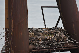
The RV park we stayed at was awesome..the camp host has been coming to this same park for 10 years and he has made pals with bald eagles, there are 6 nesting pairs. He feeds them every day so I got some wonderful pictures of the bald eagles.
We could see the Ring of Fire and don't you think that phrase "Ring of Fire" sounds as if it belongs in a Tolkien epic, but on the Kenai Peninsula, Cook Inlet, this geological phenomenon, referring to volcanic activity on the boundary of the Pacific Tectonic Plate, has written an epic of its own, starring the five volcanoes visible across the Cook Inlet, we saw these beauties from the RV site, because it sits high above Cook Inlet overlooking them.
The tremendous energy generated by this subduction is responsible for pushing up the area's mountain ranges, shaking the surface with frequent and sometimes devastating earthquakes, and heating material from the Earth's mantle which occasionally finds its way to the surface as lava. However, with the exception of Redoubt's spring 2009 eruption, these five magnificent mountains have spent the last three decades in relative quiet. In 2006, the island mountain of Augustine burped steam and ash tens of thousands of feet into the air, but what seemed to be a precursor to an eruption – like the one that rained ash on Homer and Seldovia in 1986 – instead petered out.
Volcanoes visible, from north to south, are:
Mount Spurr
11,070 feet tall
Erupted: 1953, 1992
Mount Redoubt
10,197 feet tall
Erupted: March 15, 2009, sending ash plumes from 30,000 to 60,000 feet high.
Dec. 14, 1989 - June 1990, creating 12-mile-high ash clouds.
Mount Iliamna
10,016 feet
Non-eruptive events recorded since 1741.
Mount Augustine
4,134 feet
A volcanic island in Kamishak Bay.
Erupted: 1883, 1908, 1935, 1963-64, 1976, 1986 and 2005-06.
Mount Douglas
7,020 feet
Inactive since the most recent Ice Age.


